 |
| Glacier hike |
Tues 24
Early buffet breakfast in the Hof 1 Hotel, then we rendezvoused at 09.00 with Local Guides in the petrol station car park at Fresnes ready for our half day glacier introduction hike.
Glaciers and ice caps cover 11% of Iceland, with Vatnajokull as the world’s most voluminous glacier outside the arctic regions, measuring 8,100km2 and an average thickness of 400m! We were going to tackle one of the southern 'tongues'

We were introduced to our young guide Magnus, and kitted out with harness, helmet, ice axe and crampons. By luck, we ended up with a private tour as nobody else joined our last minute group (8) booking made two days ago. A short ride in the Ford van kitted out with monster tyres took us to the foot of the glacier tongue.
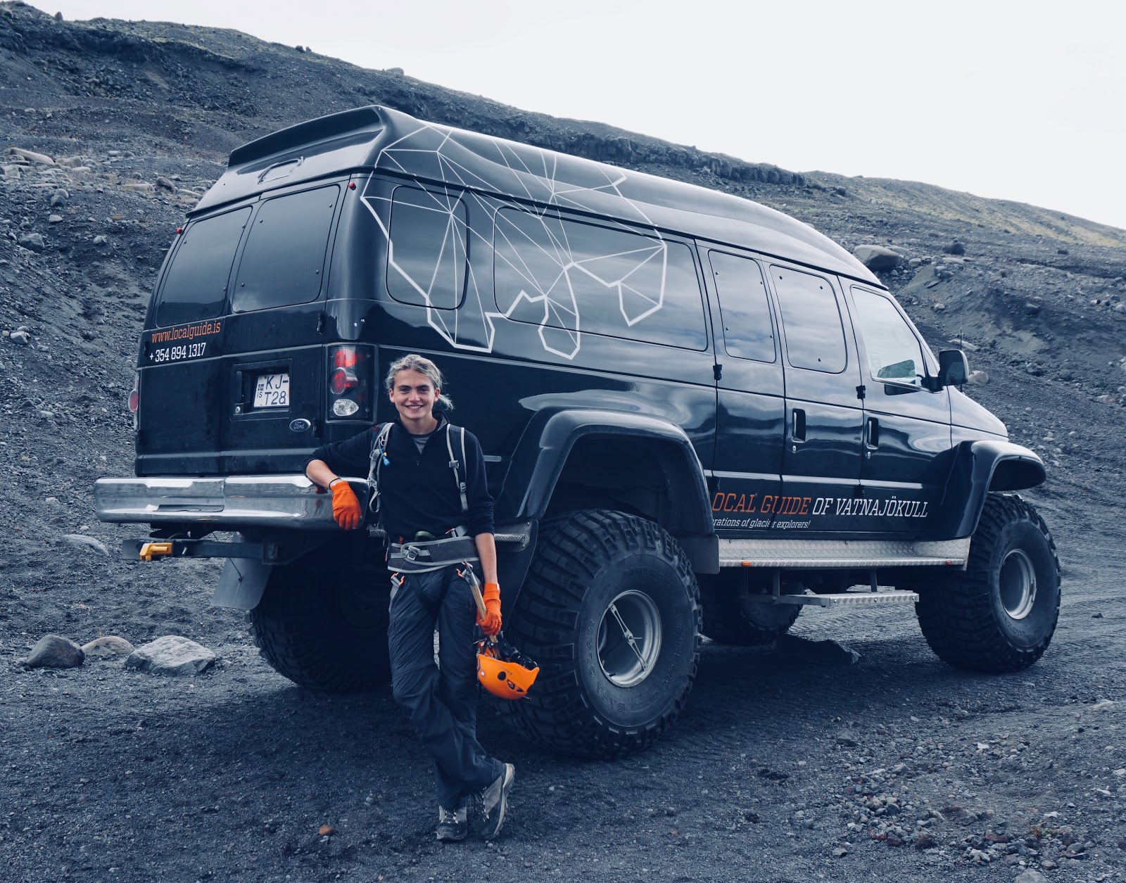
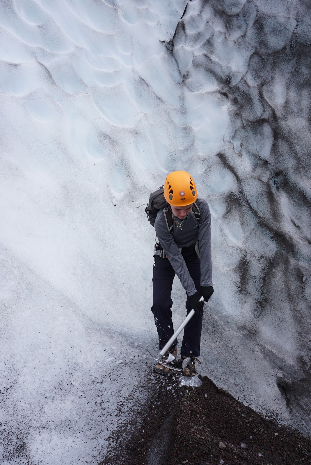
Magnus was keen to get us going quickly to stay ahead of the other tours; as the glacier recedes, the route options have reduced so the various tour companies are competing for space). Up onto the ice, where we were shown how to fit our crampons, and a quick lesson how to use them and the ice axe.
 |
| Hard-core ice kit |
Magnus lead us quickly but carefully up the stunning terrain; crunching up with crampons is a curiously satisfying sensation - with excellent grip and actually comfy as the top surface is relatively soft (for a 1000 year old chunk of ice!)


 |
| Annie testing her axe! |
 |
| Ben testing crampons & axe! |
The shapes and colours were enchanting, but looking up at the vast face carving its way down the mountain gives you some idea of the phenomenal power at work. And the sheer scale is awesome, and hard to capture: look carefully at the photo below and see the group bottom left-hand side:
 |
| Look carefully: see the group bottom left at foot of glacier face! |
 |
| Crevasses towards the bottom |

 |
| Lone climber heads up |
We were all genuinely sad when our three hours on the glacier came to an end...

This hike was right up there in the highlights of our trip, and Magnus was an excellent guide.
 |
| Guide Magnus checks out the ice-bridge.. |
Back into the Duster, and we continued west, passing through Vik (no big thrill) and stopping to marvel at the black sand and basalt columns of Reynisfjara beach
 |
| Bizarre cloud formation above the basalt columns |

 |
| Competing with Ben's stone columns |
Jess brilliantly booked a luxurious AirBnB house for the next two nights - 5 km up a gravel road in the middle of the vast, sweeping seaside floodplains.
 |
| 23.30: Our abode on the right with lights on (white house is owner). Glacier behind! |
Weds 25
Today we drove back east on the Route 1 to admire the 62m Skogafoss waterfall and then we walked north up the Skogargil trail.

This is the route for the two day hike crossing between Eyjafjallajokull (famous for the 2010 eruption that actually heralded the Iceland tourism boom) and Myrdalsjokull glaciers at the Fimmvorduhals pass; a potential hardcore extension to the Laugavegur) and also the site of the infamous 2010 eruption.


It’s an amazing path as there are 22 waterfalls if you make it to the top. However, we only managed 4km before finding shelter from the increasing rain to eat our sandwiches and then back down in full waterproofs - which we then pressure tested by standing next to the Skogafoss plunge pool!
 |
| Pressure testing my waterproofs (Green jacket, on the right) |
Comments
Post a Comment